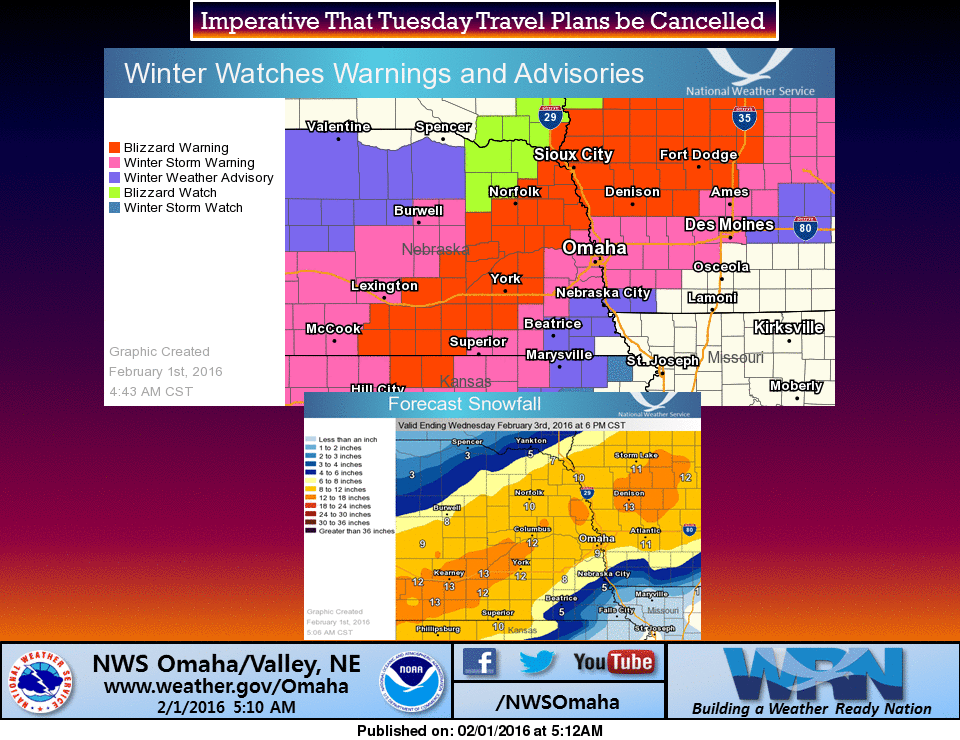
*On a separate note, a blizzard warning doesn't have anything to do with snowfall amounts. A blizzard warning is based on wind speed and visibility.
|
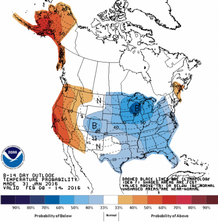
The upcoming storm will impact most of Nebraska and Iowa Monday and Tuesday. The warm weather over the weekend melted most of the current snow, but the pending storm will bring around a foot (+\- 6" in places) of fairly wet/heavy snow with a lot of wind. Unlike many Mid-winter snowstorms, this event is not followed by very cold temperatures and the winds will die down quickly. This will hopefully mean a speedy recovery from the winter blast. However, it looks like a big cool down is headed our way next week and bring in very cold temperatures. Our January thaw was short-lived. *On a separate note, a blizzard warning doesn't have anything to do with snowfall amounts. A blizzard warning is based on wind speed and visibility.
0 Comments
Leave a Reply. |
AuthorI study weather and climate impacts on agriculture, climate variability, and using weather and climate information to make better agricultural decisions. Archives
November 2017
|


 RSS Feed
