|
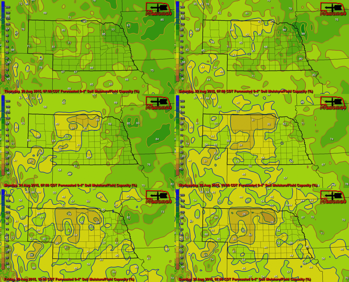
The image below from the Nebraska Mesonet shows the forecasted 0-4" soil moisture to field capacity ratio using the GFS forecasting model. Most of Nebraska is expected to dry-out some over the next 10 days, especially in central, north central, and western Nebraska. Values over 100% are considered to be above field capacity.
1 Comment
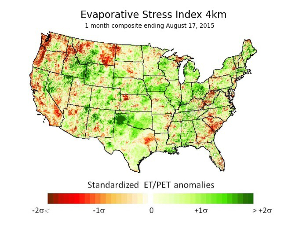
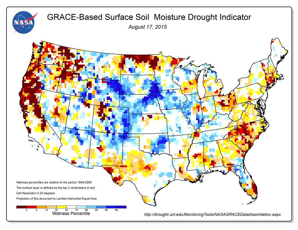
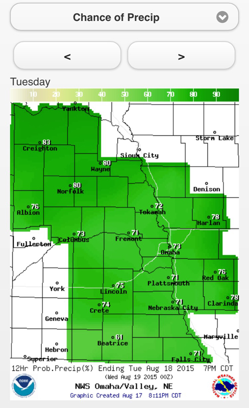
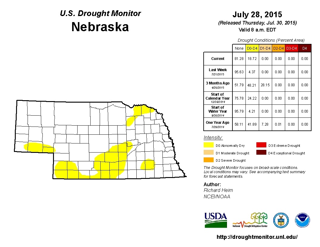
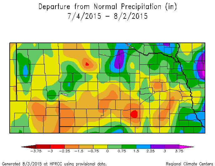
The 1-Month Evaporative Stress Index shows the ratio of actual ET to potential ET over the last month in the U.S., which can be an early (and current) drought indicator. In Nebraska, small pockets exist with early drought conditions, but most of these areas have received adequate moisture recently as seen in the soil moisture satellite image from August 17. The moisture received today in SE Nebraska will enhance the signal in that area. All in all, many areas in Nebraska are sitting in a good position to get the crops to maturity with current, and forecasted, conditions. Rain chances move back in this weekend with another cool down. There is another good chance of precipitation on Tuesday for eastern Nebraska, especially in northern portions. Chances return again this weekend with another cold front. Portions of Nebraska have been very dry over the last 30 days. Temperatures have been near to above normal, increasing the moisture demand. The drought monitor last week increased the coverage of abnormally dry conditions and I would suspect the area will increase, with the potential increase in drought severity in the southwest.
|
AuthorI study weather and climate impacts on agriculture, climate variability, and using weather and climate information to make better agricultural decisions. Archives
November 2017
|
| Ag Climate Nebraska |
|
 RSS Feed
