|
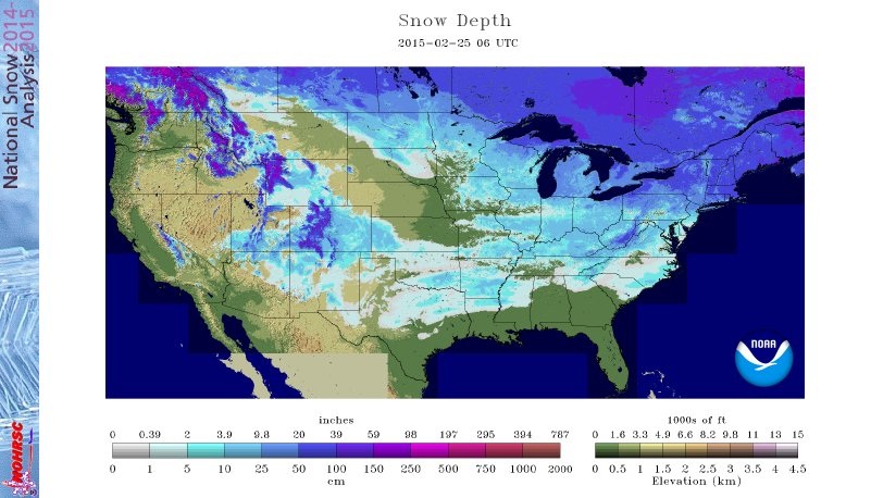
The latest Snow Depth map from NOAA shows Nebraska with the least amount of snow depth of any state in the Midwest and High Plains and only second to Florida (which has none) in the continental U.S. This is due to the warm temperatures received by the central and western portions of the state the last couple weeks and the strategic placement of the recent winter storm tracks.
0 Comments
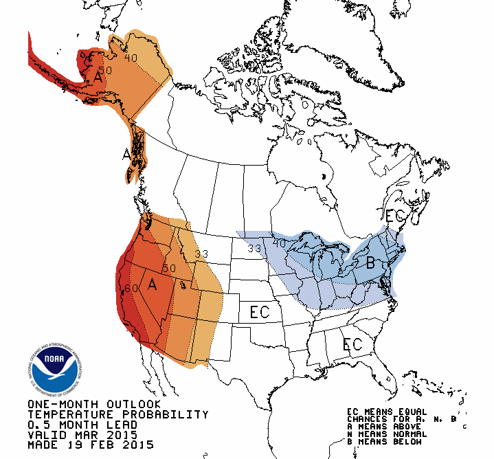
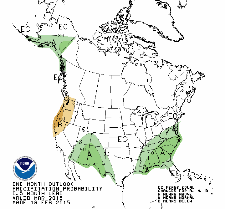
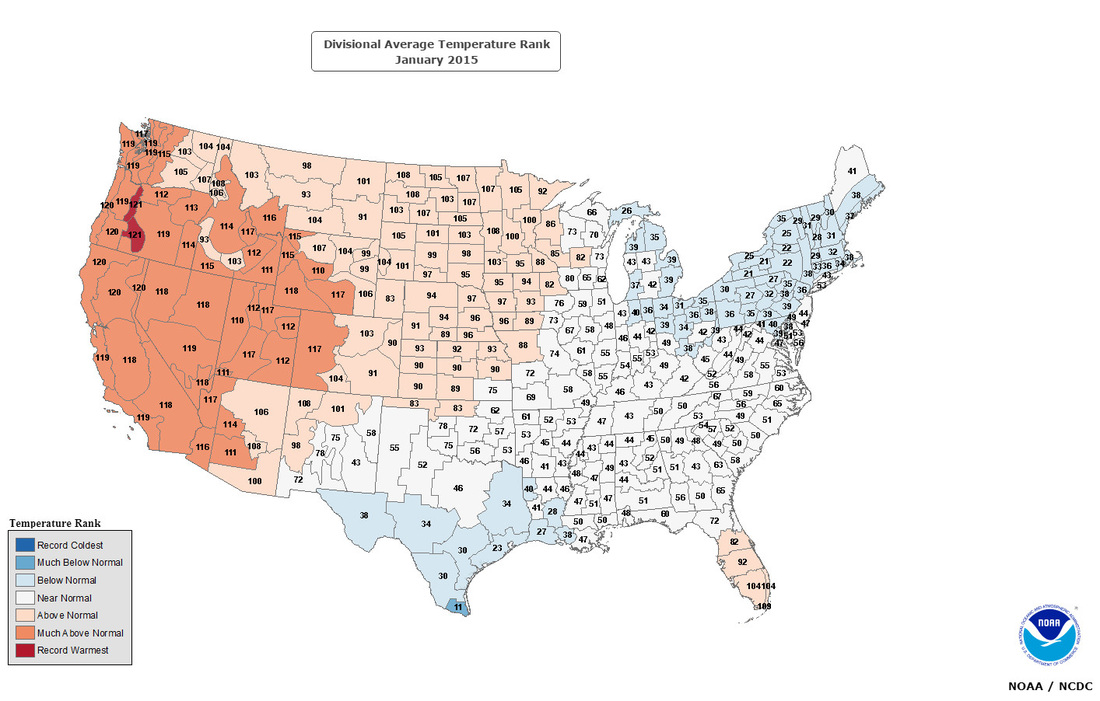
The Climate Prediction Center (CPC) has released the temperature and precipitation outlooks for March. Nebraska remains in the area of equal chances for above or below normal temperature and precipitation. This is similar to the pattern that we have been in for the past couple weeks. Cool temperatures in Eastern Nebraska and warmer temperatures in Western Nebraska. We have been the dividing line for extremely cold temperatures and warm temperatures, and this outlook seems to show that this pattern may continue for a while. Although, that steep temperature gradient could shift east or west. A shift in the jet stream could move Nebraska into the warm sector or deeper into the cold sector. My guess is that we will remain in that transition zone and continue to have these temperature gradients from the Northeast to the Southwest NE with periodic episodes of warm and cool temperature swings. The precipitation pattern is up in the air at this point. We could easily get stuck in the track of numerous storms which will continue to traverse the trough over the Eastern U.S, but that is too difficult to predict this far out.
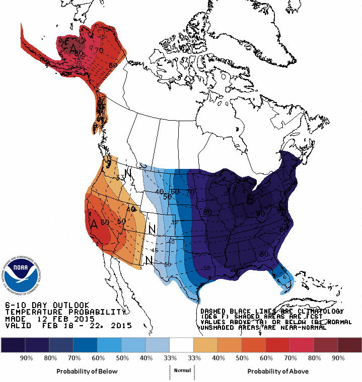
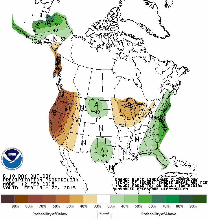
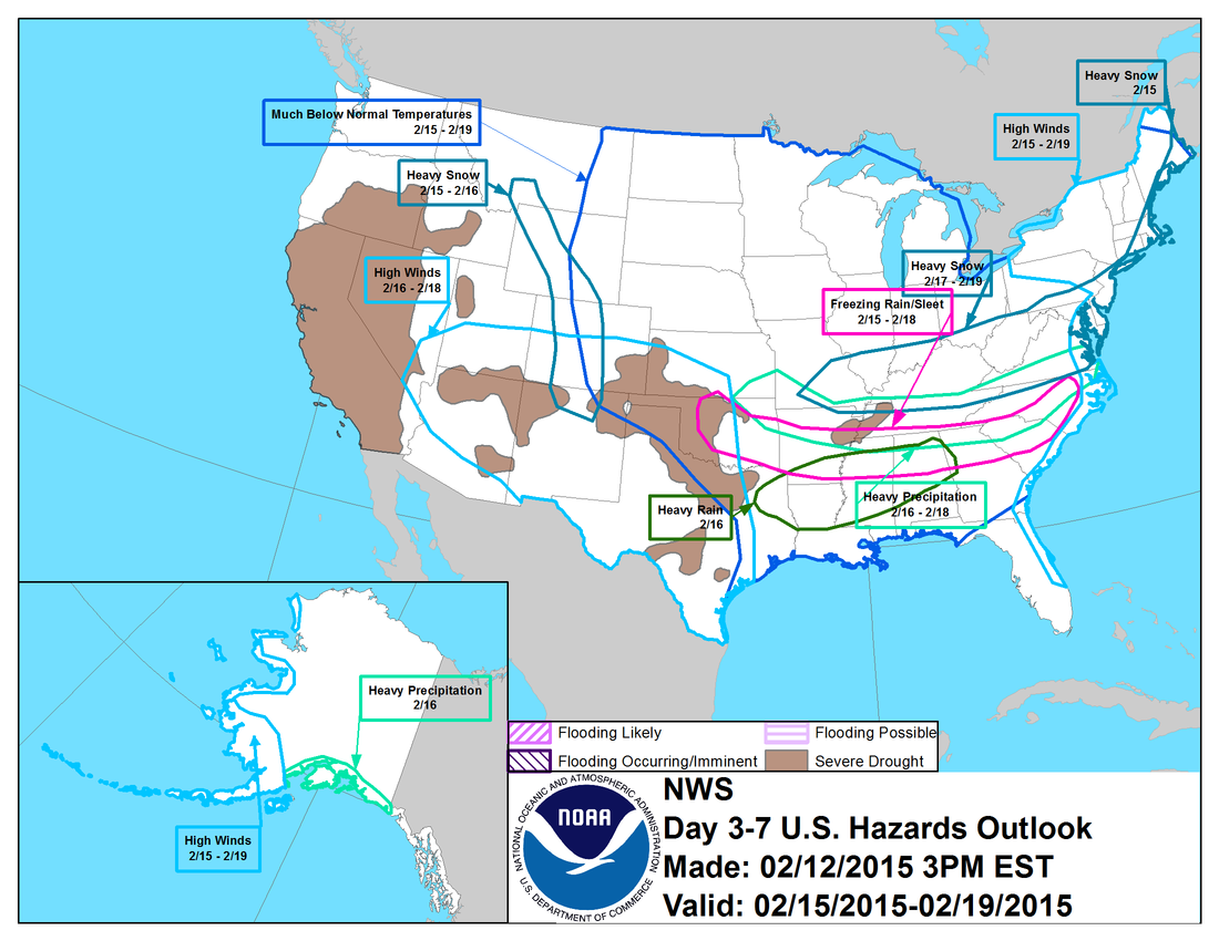
The forecast from the CPC for the next 6-10 days shows the cold air pushing in from Canada. As this cold air pushes southward, so do our chances for precipitation. The forecast for the storm tracks look to stay to our south, if this pattern persists.
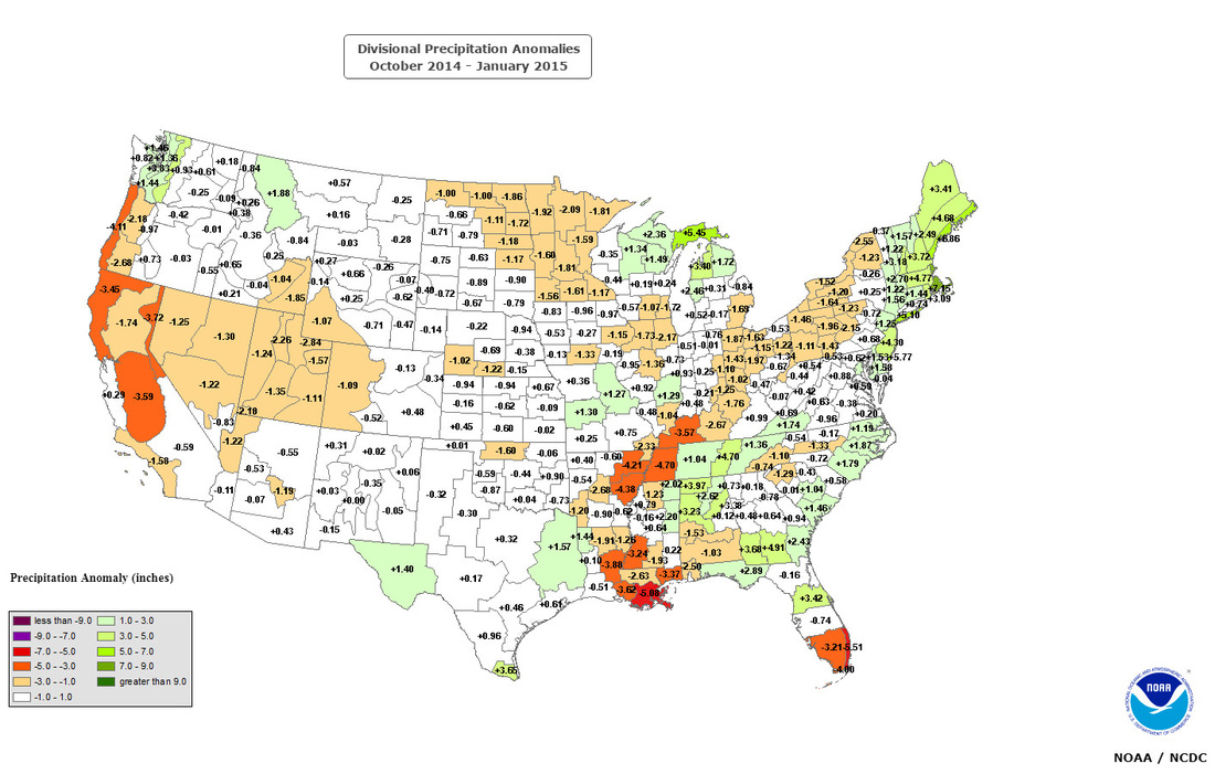
Late fall through the spring is a time when agricultural area build up a soil moisture reserve. Fall and spring rain events and winter snowfall that fill the soil profile are critical for crop germination and early spring growth. Some areas of the country have seen below normal precipitation since October 1st, especially in some areas of the corn belt. Late winter and spring precipitation will need to make up for the deficit in order to have adequate soil moisture heading into planting season.
AR's are, on average, 400-600 km wide. The west coast gets 30-50% of it's annual precipitation in just a few AR events. In the strongest cases ARs can create major flooding when they make land-fall and stall over an area. More facts found here.
|
AuthorI study weather and climate impacts on agriculture, climate variability, and using weather and climate information to make better agricultural decisions. Archives
November 2017
|
||||||
| Ag Climate Nebraska |
|
 RSS Feed
