Here is a map and short-text version of the latest weather and climate news in Nebraska.
Neb Rundown:
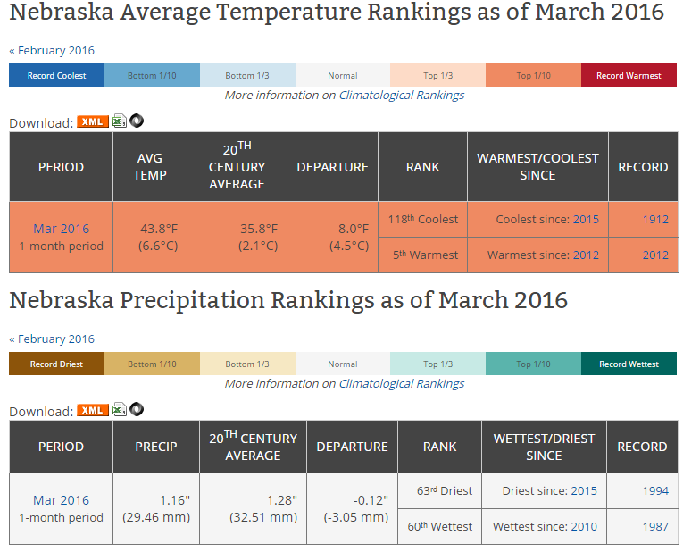
- March was 5th warmest on record and near normal for precipitation.
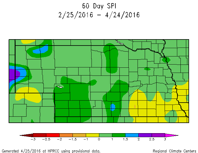
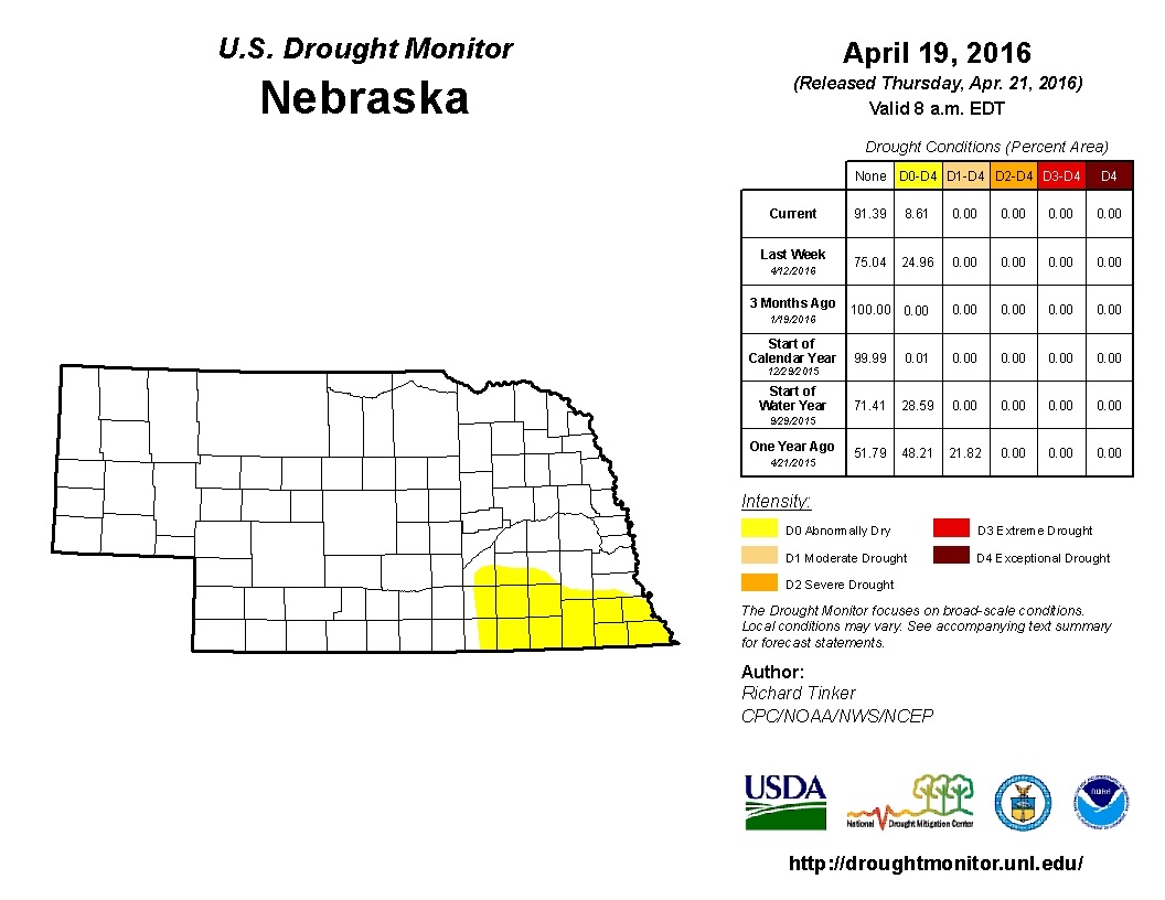
- 60-Day SPI (Standardized Precipitation Index) shows a deficit in SE Neb, which mimics the Drought Monitor. SPI is typically used to detect drought conditions during the growing season. Recent rain may alter the next drought monitor.
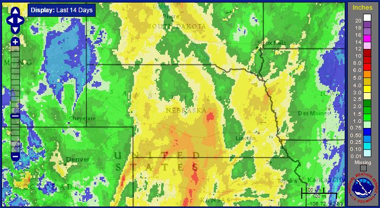
- Estimated rainfall over the last 14 days saw 3-4" covering 2/3 of the state
- 14-Day average temperature was 2-6 degrees F above normal
Forecast
- Severe weather is expected Tuesday for the Central Plains. Large hail and strong tornadoes possible from southern Nebraska to southern Oklahoma. Storms will initiate on warm front in Nebraska, so location of warm front in late afternoon/evening will be the key.
- 7-Day precipitation forecast (QPF) shows a lot of moisture in Central Plains, up to 5"+ in E. Neb.
- 8-14 Day Outlook (thru May 2-9) shows below normal temps and above normal precip during that time period for Nebraska and large portion of U.S., but could be transitioning back to warmer weather during this first week of May. Cool over the next 10 days, but does not look like hard frost risk. Get used to the 50s and 60s for highs for a while.
Neb Rundown:
- March was 5th warmest on record and near normal for precipitation.
- 60-Day SPI (Standardized Precipitation Index) shows a deficit in SE Neb, which mimics the Drought Monitor. SPI is typically used to detect drought conditions during the growing season. Recent rain may alter the next drought monitor.
- Estimated rainfall over the last 14 days saw 3-4" covering 2/3 of the state
- 14-Day average temperature was 2-6 degrees F above normal
Forecast
- Severe weather is expected Tuesday for the Central Plains. Large hail and strong tornadoes possible from southern Nebraska to southern Oklahoma. Storms will initiate on warm front in Nebraska, so location of warm front in late afternoon/evening will be the key.
- 7-Day precipitation forecast (QPF) shows a lot of moisture in Central Plains, up to 5"+ in E. Neb.
- 8-14 Day Outlook (thru May 2-9) shows below normal temps and above normal precip during that time period for Nebraska and large portion of U.S., but could be transitioning back to warmer weather during this first week of May. Cool over the next 10 days, but does not look like hard frost risk. Get used to the 50s and 60s for highs for a while.
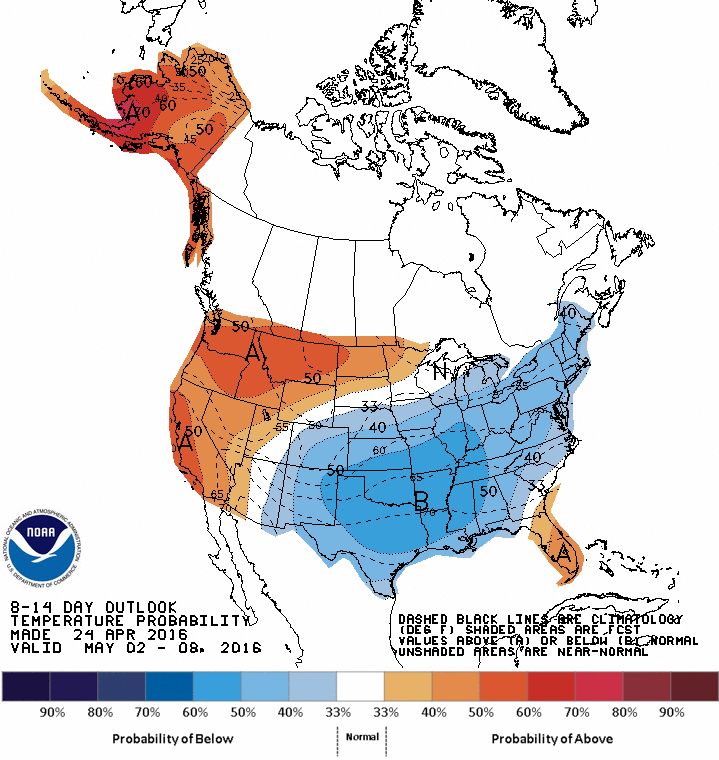 8-14 Day Temp Outlook 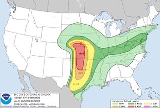 April 26 (Tues) Severe Outlook | 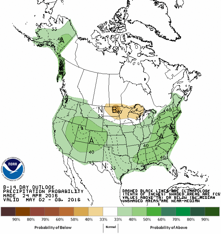 8-14 Day Precip Outlook 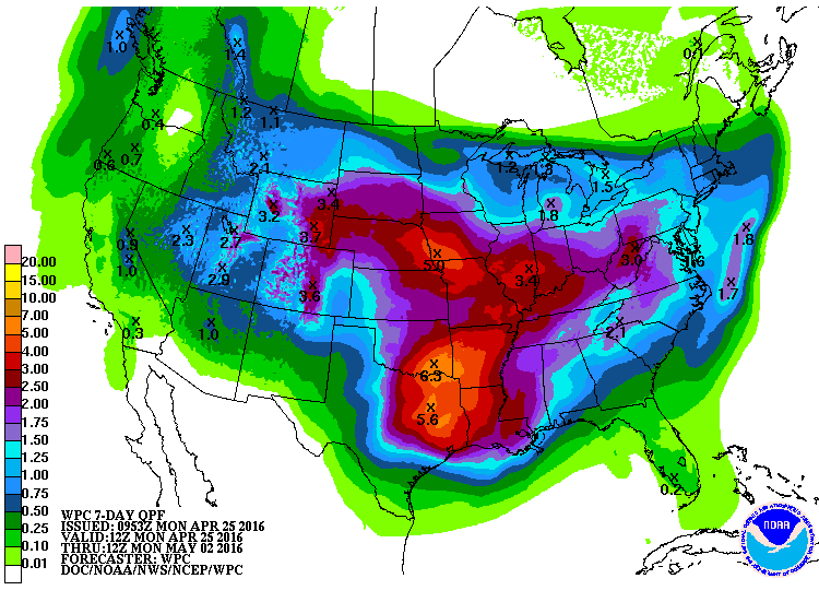 7-Day QPF |
 14-Day Radar Estimated Precip | 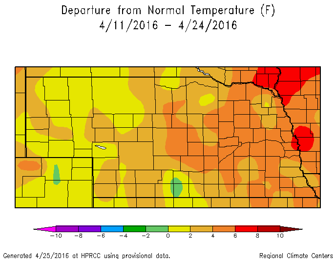 |
 |  |
 RSS Feed
