| nebraska_ag_climate_update_-_september.pdf |
|
0 Comments
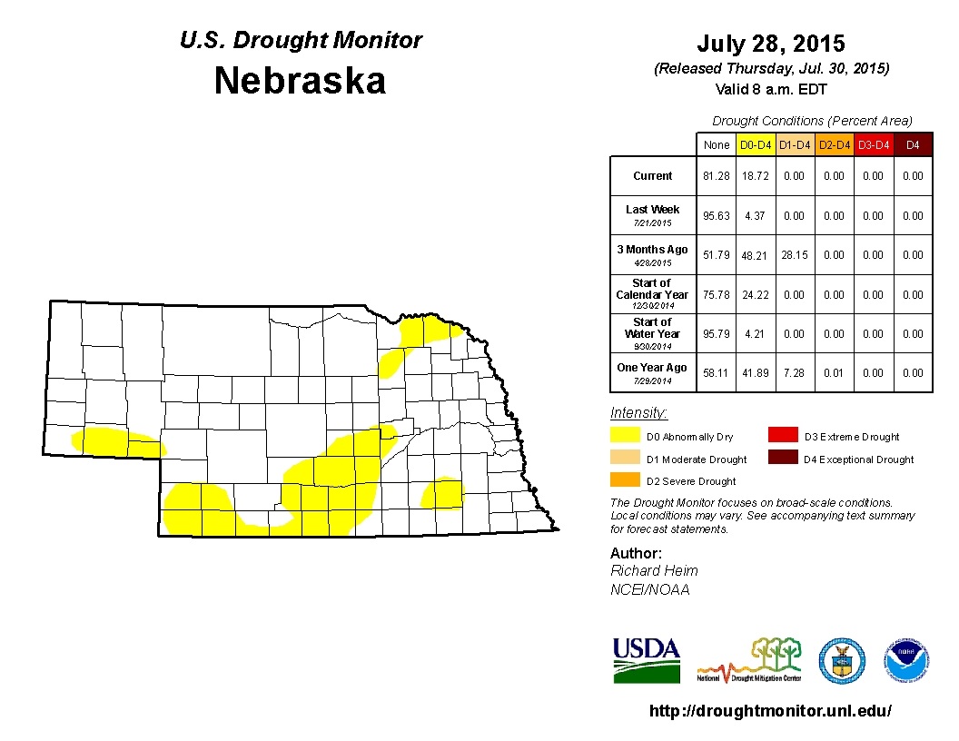
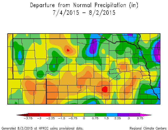
I would very much appreciate your feedback on the Ag Climate Nebraska blog, twitter feed, and newsletter. I will use this information to enhance future information and make it better for the end user. Follow on Twitter: @tylerw_unl The average first 32F freeze from 1981-2010 (most recent climate normals) for Nebraska is during the last 10 days of September for most of western and northern Nebraska and the first 10 days of October for southern and Eartern Nebraska. The latest date for the first 32F freeze for the same time period was the first week of November for the southeast and the middle of October for the northwest. For the other extreme (the earliest first freeze), came during the middle of September for most of Nebraska with the far northwest panhandle having its earliest first freeze in the middle of August. This illustrates the wide range of possibilities for the first 32F freeze for Nebraska. There is a two month window for the first freeze, which may provide opportunity for late fall growth of grasses or cover crops. However, an unseasonably early freeze may limit crop maturity. This is a challenge every year for crop producers and forecasts out past 7 days just aren't able to accurately predict the potential of a frost. The lack of long range freeze forecasts limits the ability to make management decisions that may be able to capture an extended growing season or prevent problems from an early ending. 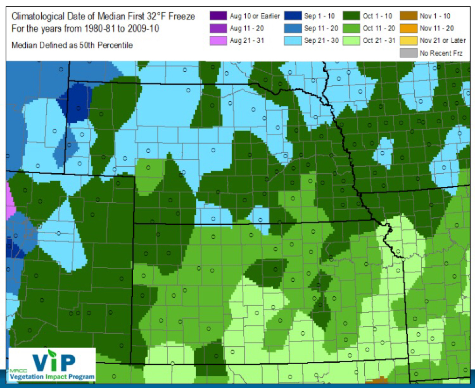 The image below from the Nebraska Mesonet shows the forecasted 0-4" soil moisture to field capacity ratio using the GFS forecasting model. Most of Nebraska is expected to dry-out some over the next 10 days, especially in central, north central, and western Nebraska. Values over 100% are considered to be above field capacity. 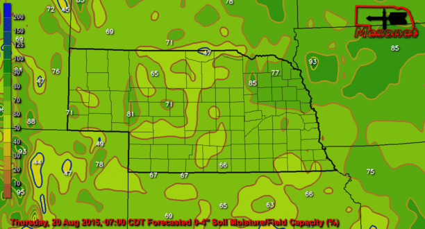 The 1-Month Evaporative Stress Index shows the ratio of actual ET to potential ET over the last month in the U.S., which can be an early (and current) drought indicator. In Nebraska, small pockets exist with early drought conditions, but most of these areas have received adequate moisture recently as seen in the soil moisture satellite image from August 17. The moisture received today in SE Nebraska will enhance the signal in that area. All in all, many areas in Nebraska are sitting in a good position to get the crops to maturity with current, and forecasted, conditions. Rain chances move back in this weekend with another cool down. 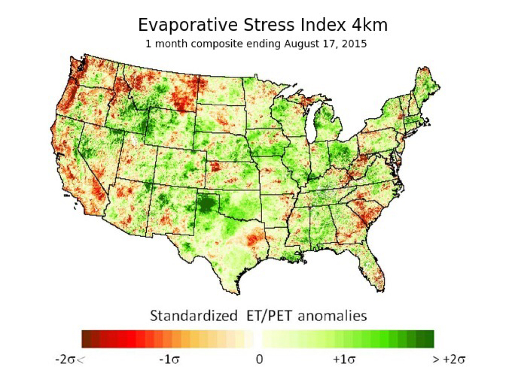 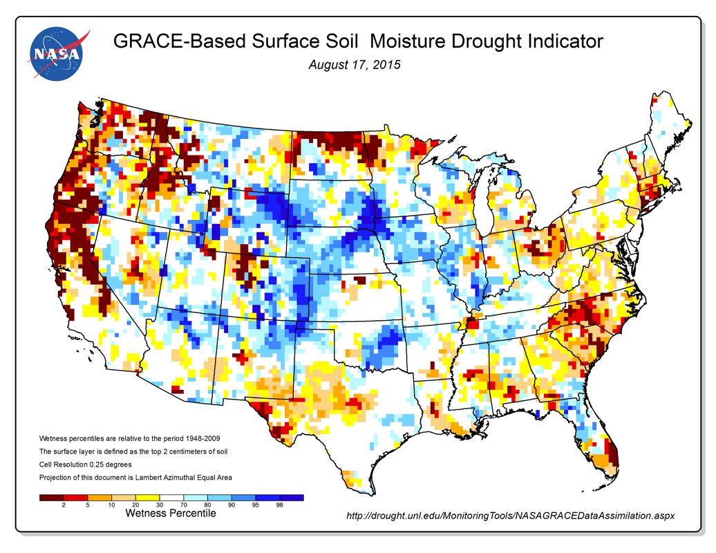 There is another good chance of precipitation on Tuesday for eastern Nebraska, especially in northern portions. Chances return again this weekend with another cold front. 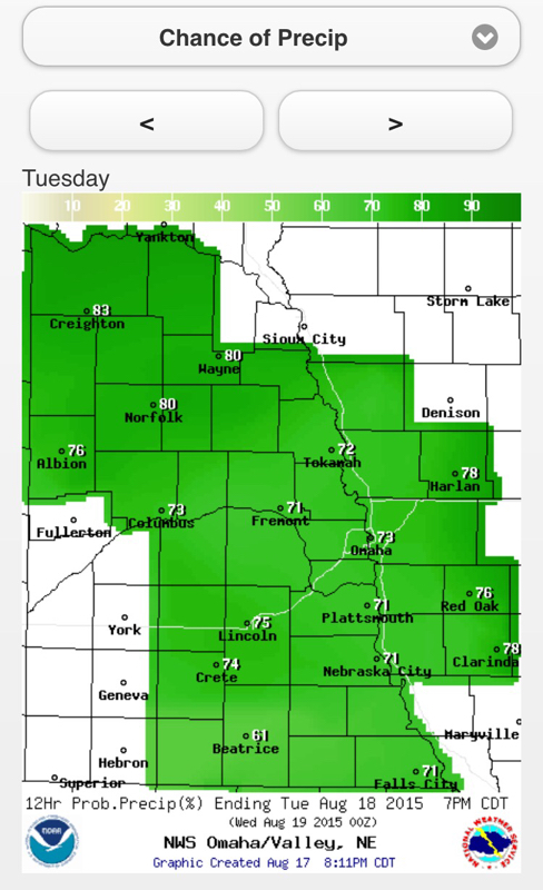 Portions of Nebraska have been very dry over the last 30 days. Temperatures have been near to above normal, increasing the moisture demand. The drought monitor last week increased the coverage of abnormally dry conditions and I would suspect the area will increase, with the potential increase in drought severity in the southwest.
|
Ag Climate Update ArchiveAuthorI study weather and climate impacts on agriculture, climate variability, and using weather and climate information to make better agricultural decisions. Archives
March 2017
|
 RSS Feed
