The Climate Prediction Center release the One-Month and Three Month Outlooks, with some interesting features for Nebraska and the Central U.S. There are increased odds for below normal temperature and above normal precipitation for Nebraska. This would suggest the expectation for the recent weather pattern to continue into June. We have been seeing a number of storm systems track across the central U.S. and has kept us wet and relatively cool. Although individual storms may veer off this path, there does seem to be some confidence that the middle part of the country could expect to see continued delays in planting, especially with already wet soils. This region is also very wet and this will decrease our overall temperatures.
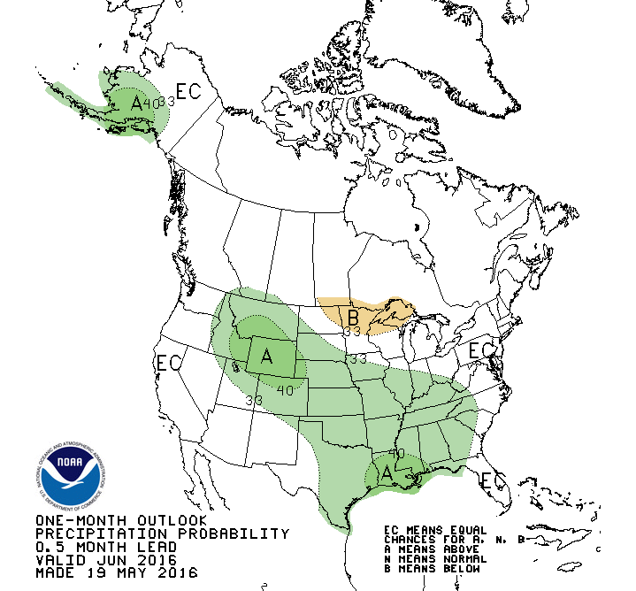 One-Month Precip Outlook | 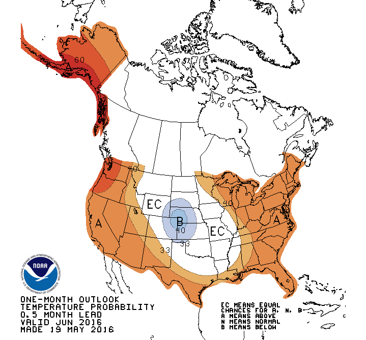 One-Month Temp Outlook |
The Three-Month Outlooks have also picked up on this pattern with above normal precipitation expected for the Central U.S. This signal was not evident in last months outlook for the June, July, August time frame. The temperature outlook also reflects this precipitation pattern with equal chances for above or below normal temperatures, which was in the area with increased odds for above normal temperatures last month. The La Nina does not seem to be playing a role in the outlooks for June-August; however, it does seem to show up in the August-October outlooks. Notice the removal of the areas for below normal precipitation in the Great Lakes and eastern Corn Belt.
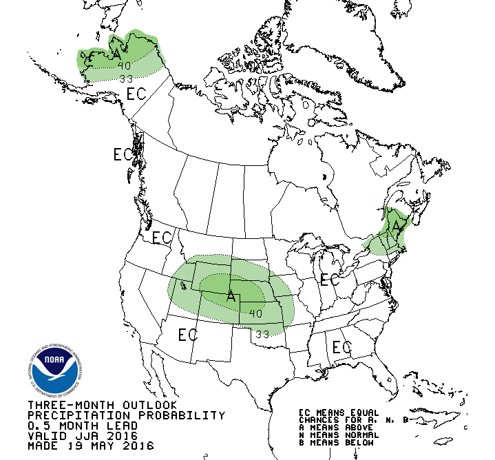 Three-Month Precip Outlook | 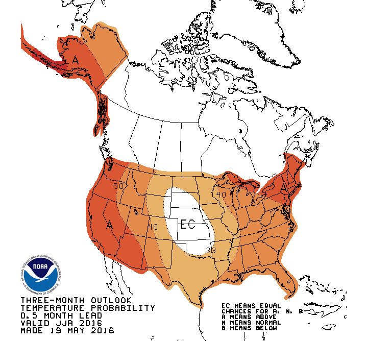 Three-Month Temp Outlook |
What does this mean??? An expectation of our current pattern continuing over the next 20-30 days would keep the June temp below normal and precip above normal. This could be enough to sway the three-month outlooks that are floating around the "Equal Chances" categories for July and August due to the unknowns with the transition to La Nina. So, one cool and wet month could have a big impact on a three-month average, if the other two months are average. I don't think we are seeing a huge pattern shift for the summer, but it does look we may stay wet for a while. It is important to remember that most of our summer precipitation is from convective events (thunderstorms) and we all know how "spotty" these events can be. It is always very easy to miss out on these timely events and encounter localized drought stress during rapid vegetation growth.
 RSS Feed
