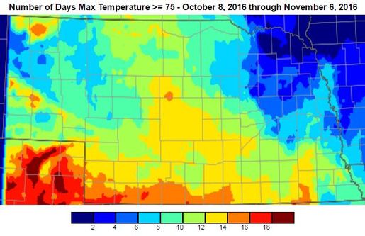
For most people in Nebraska, the weather the past few weeks has been fantastic. Average temperatures over the last 30 days have been 6-8°F above normal for almost the entire state. The average highs in October ranged from the mid 70s in the southwest to the mid 60s in the northeast. Average lows were mid 40s in the southeast and mid 30s in the panhandle. The first week of November has been much of the same many of us haven’t seen freezing temperatures for quite some time.
The Bad
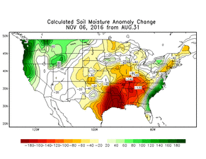
Warm temperatures in the fall are often accompanied by dry conditions and that is exactly what we got. Last month, “The Bad” was also a lack of precipitation, and we added about 30 days of dryness to that. Almost all of the state received less than 0.50” over that past 30 days, which is 0.5-2.0” below normal. The dry and warm weather continued to dry out the soil, even with decreasing daylight hours. This has limited potential wheat and cover crop growth and ended the pasture grazing season a little early.
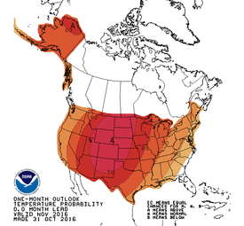
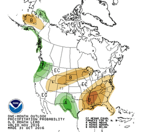
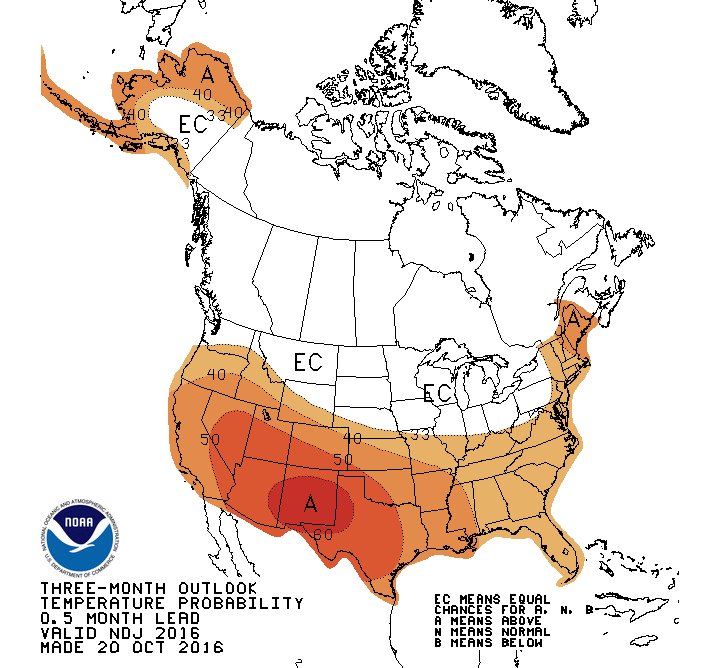
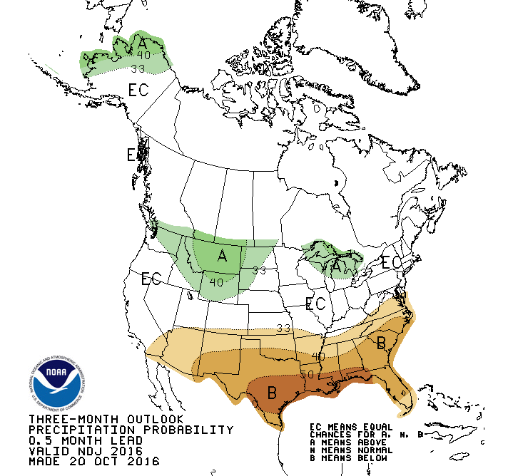
| The Outlook The short-term forecast is shaping up to be quite pleasant for the second week of November. A disturbance is moving through the state to start the week, but it is a warm-system moving from the southwest. This will keep temperatures above normal and bring in slight chances for light precipitation. The strong ridge that has been keeping the cold air to the north will stay in place for quite some time. The rest of the week looks to be warm with highs in the 60s and lows in the upper 20s and lower 30s. This ridge will also limit the chance for precipitation as well. With current soil temperatures in the 50s across the state, this warm forecast will keep soil temps above the 50°F mark for many locations in Nebraska for a while. The week two forecast is currently a continuation of the same warm and dry weather. Right now, it looks like this ridge will continue to keep the cool and wet conditions away from the middle part of the country through the beginning of next week. We all know the bottom will fall out eventually, and we will be back to November-like (or worse) weather, but the models are just not picking up on when that will happen. The November outlookshows warm and mostly dry for the U.S., but is probably heavily favored by the conditions of the first two weeks of the month. I suspect the last half of November may be quite different. Looking towards the winter months, our forecast has changed slightly since the last Update. The infamous La Niña is back in the equation and this increases the chances for have near-normal to below normal temperatures during the winter season. We will enter the winter with warm conditions, but the typical La Niña pattern utilizes a strong polar jet to bring in cool/moist air from the northwest. The best chances for this are in the northern states; however, we are very close to those northern states. Tyler Williams, Nebraska Extension Educator Cropping Systems and Climate Resiliency [email protected], |
 RSS Feed
