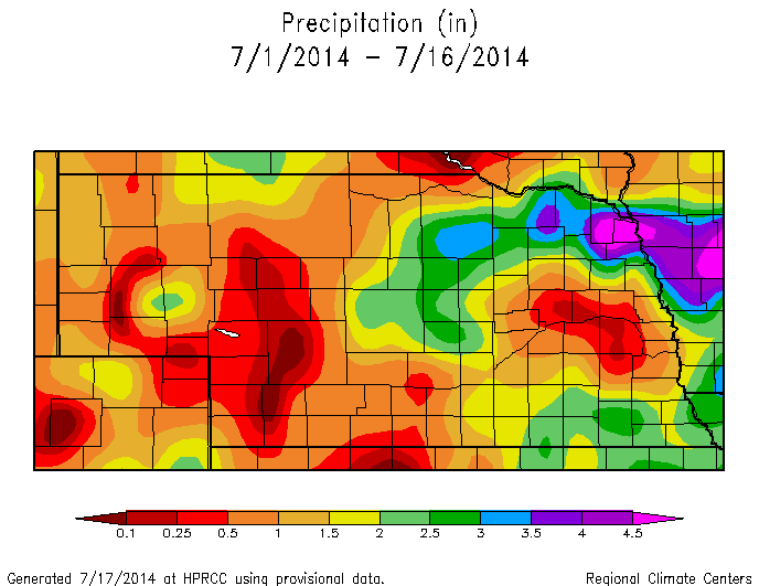
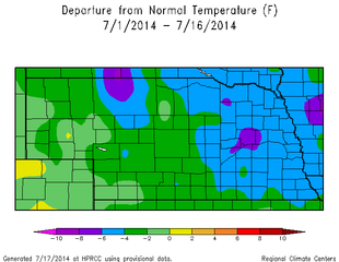
Quick Overview: Crops are reaching peak ET, and with the recent dry spell for many people in Nebraska, soil moisture monitoring and irrigation is at an important stage. The recent cool weather has limited the atmospheric demand component to ET, but the forecast is telling us that this will change. Temperatures will climb into the upper 80s this weekend and into the mid 90s next week. Precipitation chances remain small, if not non-existent, for most of Nebraska for the next week. Small thunderstorms may develop, but the ridge of high pressure and upper level northwest flow will limit any valuable accumulations.
The trough centered over the Great Lakes is the predominant feature in 7-14 day weather forecasting models. Shortwaves running around the trough look to bring a few disturbances and cooler temperatures to Nebraska, but will primarily affect Eastern and Northeast Nebraska. The location of this trough and strength of the shortwaves may have a profound impact on temperature prediction in the state. With that said, the weather pattern is looking like it will remain summer-like (warm and dry) through the end of July.
The Three-Month Outlook from the CPC, which covers August, September, and October have increased odds for below normal temperatures for the Northern Plains with high confidence in below normal temperatures for Nebraska. They also have a large area of the U.S. in the area of increased odds of above normal precipitation for the 3-month period. This area runs from Southern California, north and east to Wyoming and Nebraska, and down to western Texas. They are expecting the monsoon conditions over the 4-corners region to be the dominant feature in the upcoming months. These conditions are typical with an El Nino, which is still being predicted for this fall and winter. What this means for farmers is a potentially delayed harvest with cooler and wetter than normal conditions; however, I have not seen the data on a correlation of an El Nino and an early frost. It is still way too early to predict the potential first frost (I don’t want to think about frost just yet).
| 
|
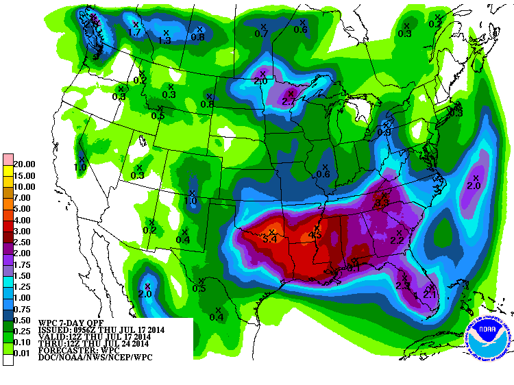
7-Day Total Precipitation Forecast (July 17-July24)
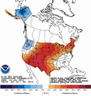
6-10 Day Temperature Outlook from the CPC
| 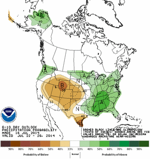
6-10 Day Precipitation Outlook from the CPC
|
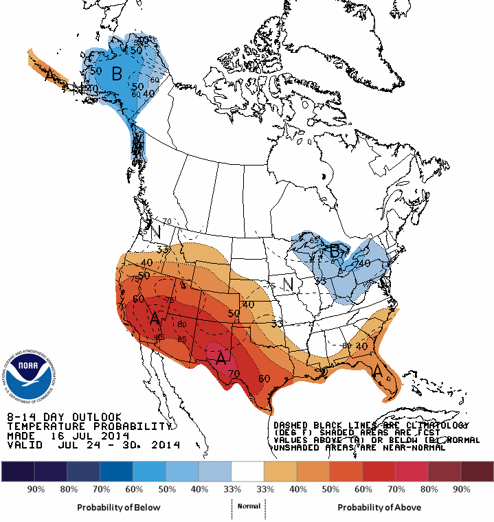
8-14 Day Temperature Outlook from the CPC
| 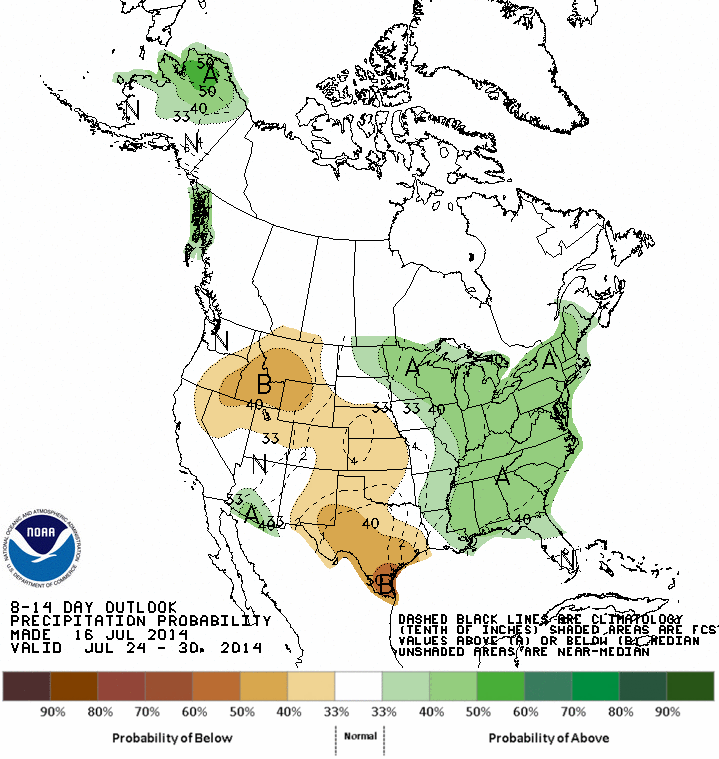
8-14 Day Precipitation Outlook from the CPC
|
 RSS Feed
