|
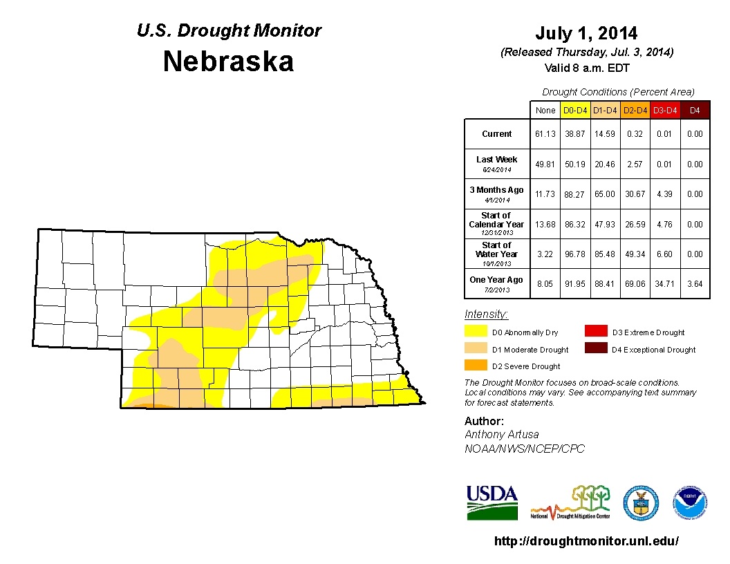
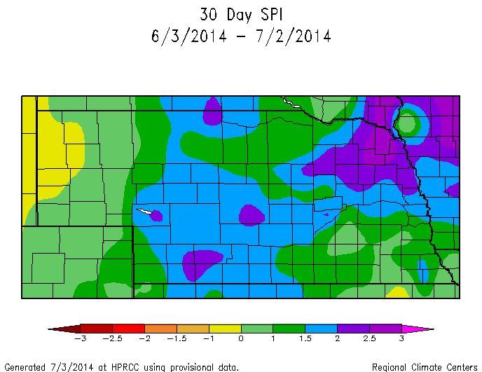
Here is the latest Drought Monitor released this morning. There was another gradual shrinking of the drought coverage area in Nebraska this week, with significant improvement in SW portions of the state. The second map below is the 30 Day SPI (Standardized Precipitation Index) and this is a drought tool that focuses on precipitation. The SPI is often a good indicator for the early detection of drought conditions during the growing season. The latest 30 Day SPI shows abnormal dryness in the Panhandle, so this is an area to keep an eye on and probably won't be picked up by the drought monitor unless dry conditions and warm temperatures persist. The long-term forecasts for this part of the state are predicting average temperatures will be below normal with above normal precipitation for the next 3-month period.
0 Comments
Leave a Reply. |
AuthorI study weather and climate impacts on agriculture, climate variability, and using weather and climate information to make better agricultural decisions. Archives
November 2017
|
| Ag Climate Nebraska |
|


 RSS Feed
