|
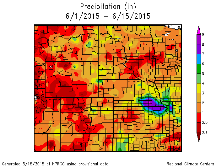
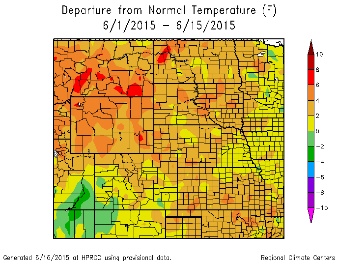
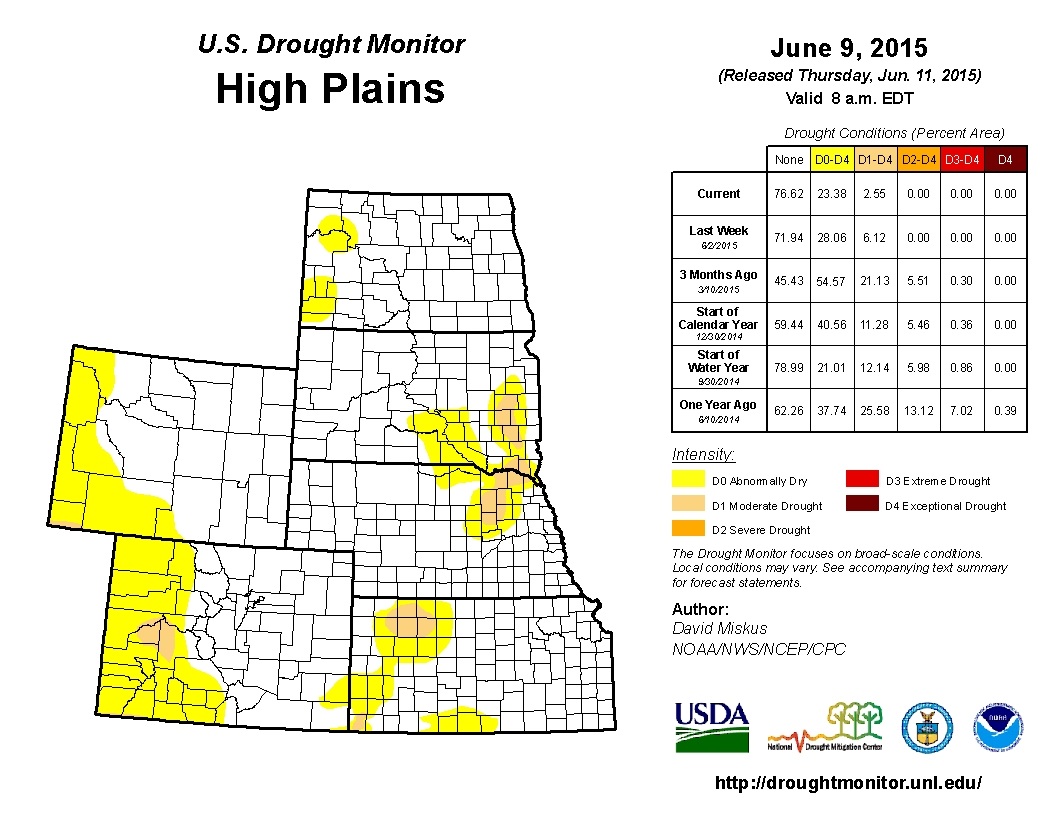
The first couple weeks of June have been fairly "normal" for most of the High Plains after a quite impressive May. The most significant impact has come from the continued rainfall in SE Nebraska and NE Kansas. Temperatures were mostly near to above normal for the High Plains, which has been welcomed after cool and cloudy weather last month. The drought monitor is pretty uneventful right now, which is always positive, especially during the growing season. Northeast Nebraska may see a little improvement in the next Monitor, but I would suspect it will remain relatively unchanged this week. The short-term forecast does show some dryer air for most of the southern High Plains with the precipitation concentrated over the Dakotas and areas east of Nebraska and Kansas. The approaching tropical storm may dump some impressive rainfall amounts over the southern plains and into the central and eastern corn belt. The forecast does not show any big changes for our weather pattern in the near future, so we may set into a near normal pattern of highs in the 80s, lows in the 60s, and small chances for isolated summer-time thunderstorms. For now, Nebraska should see some drying this week with some good growing conditions, but it may be too late for those soybean acres that have not yet been planted. The El Nino is still dominating the long-term forecast for below normal temperatures in July and August, but there is not much confidence in a detailed forecast past 7 days. Enjoy the ride of Nebraska weather.
0 Comments
Leave a Reply. |
AuthorI study weather and climate impacts on agriculture, climate variability, and using weather and climate information to make better agricultural decisions. Archives
November 2017
|
| Ag Climate Nebraska |
|


 RSS Feed
