|
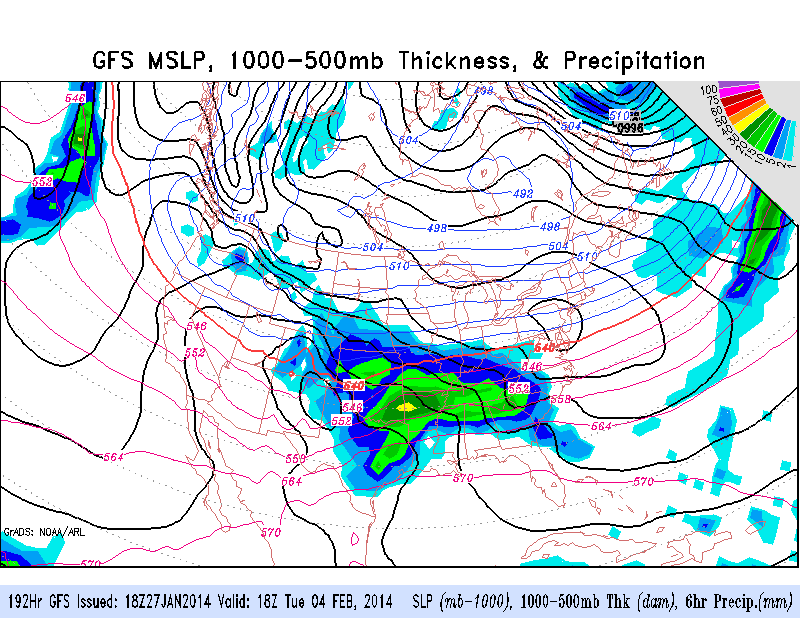
This map shows the GFS 18Z model run for the192 Hr (February 4th at 6:00 pm) precipitation prediction. The model has been fairly consistent with this storm and it's timing, but has been moving the location north and south. Seems like a significant system will move through next week, but Nebraska has been on the northern edge on each model run. This system will be a different of storm than we have seen the last month or two because it will be coming out of the Central/Southern Rockies instead of Central Canada. Temperatures will be below freezing, so it should remain an all-snow event, but it doesn't look like we will see bitter cold temperatures like the last few days. All that being said, keep an eye on the track of this event that could potentially bring in some significant snow.
0 Comments
Leave a Reply. |
AuthorI study weather and climate impacts on agriculture, climate variability, and using weather and climate information to make better agricultural decisions. Archives
November 2017
|
| Ag Climate Nebraska |
|


 RSS Feed
