|
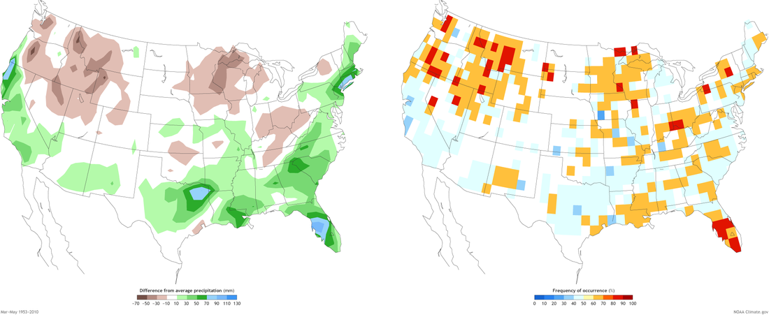
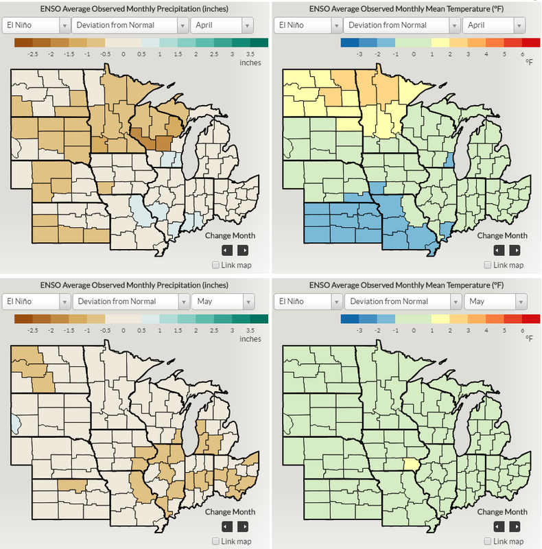
After months of being in an El Nino Watch, the NOAA CPC/IRI issues an El Nino advisory. Conditions have been borderline for an El Nino since last summer, but actual weather conditions did not align to typical El Nino patterns, but some of those features are now taking place. The typical El Nino impacts are weak in the U.S. during the spring, thus forecasts will not increase in confidence. The map below shows the precipitation pattern in the U.S. during an El Nino from March to May and the confidence associated with that pattern. As you can see from the map, there is not much of a signal for precipitation for Nebraska for the three month period. The four maps at the bottom show the deviations from normal for precipitation and temperature during an El Nino for April and May. These maps do show a slight signal for cooler and drier conditions for April and a cooler May, as compared to the 1981-2010 climate normals. View the entire story from NOAA here.
0 Comments
Leave a Reply. |
AuthorI study weather and climate impacts on agriculture, climate variability, and using weather and climate information to make better agricultural decisions. Archives
November 2017
|
| Ag Climate Nebraska |
|


 RSS Feed
